Lee declared post-tropical as it approaches southwestern Nova Scotia

[ad_1]
Lee has been declared a post-tropical storm system.
The designation of post-tropical does not mean a lessening of the expected impacts of the storm, but rather a change in the structure of it.
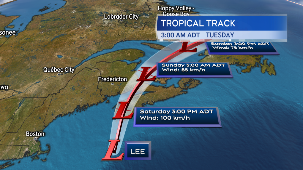
 Post-tropical storm Lee within 200 km of the southwest of Nova Scotia Saturday morning.
Recent satellite imagery of Lee now more resembles the structure of one of the Maritimes’ winter Nor’easters than the tight, symmetrical shape more common with a storm that is tropical in nature.
The centre of the storm is moving on a slight, more easterly patch compared to forecasts on Friday. The centre may make landfall near the border of Shelburne/Yarmouth counties in southwest Nova Scotia as early as Saturday afternoon.
 Track updates for Lee show that landfall is likely Saturday afternoon near the border of Yarmouth and Shelburne Counties in Nova Scotia.
Lee remains a large, sprawling storm system with widespread impacts when it comes to rain and wind.
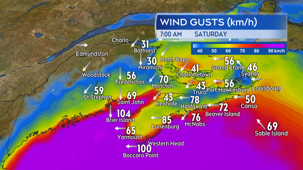
 Reported wind gusts at weather stations in the Maritimes at 7 a.m. Saturday.
WATCHES AND WARNINGS
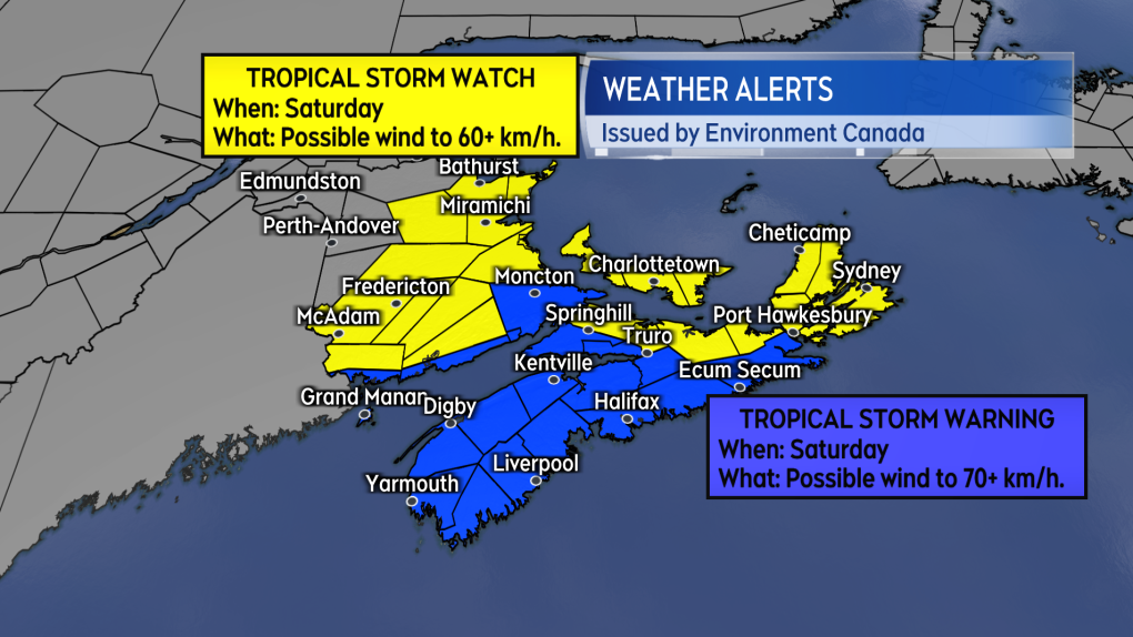
A hurricane watch remains in effect for Grand Manan and Coastal Charlotte County in New Brunswick. A hurricane watch is also in effect for the Tri-county region of Nova Scotia, the South Shore, and Halifax County. Tropical storm warnings and watches cover a larger area of the Maritimes.
The strongest winds, gusting 80 to 110 km/h, are expected on the Atlantic coastline of mainland Nova Scotia and in the southwest area of the province. Similar wind gusts are expected in southern areas of New Brunswick, especially near the Bay of Fundy coastline. Other areas of the Maritimes are at risk of intermittent gusts of 60 to 90 km/h through Saturday. There remains a risk of power outages, with the highest risk in western mainland Nova Scotia and southern New Brunswick.
 Tropical storm warnings and watches in effect for much of the Maritimes.
The heaviest rain is forecast to fall in southwestern Nova Scotia and in a broad band stretching southwest to northeast across New Brunswick. Rain totals could be as much as 50 to 100 mm, and come with an increased risk of localized flooding.
Storm surge warnings remain in effect for the Atlantic coastal areas of mainland Nova Scotia. Increased wave action during high tides bring a higher risk of elevated water levels and coastal erosion. The first high tide for the area Saturday is between 8 a.m. and 11:30 a.m.
Wind is generally expected to increase in the Maritimes Saturday morning into the afternoon. The wind will remain high for Saturday evening, with wind diminishing west-to-east overnight and Sunday morning before the wind comes down further Sunday afternoon into evening.
[ad_2]